TRAILS AND MAPS
|
The Sanctuary consists of three areas: Brookside, Meadowside and the original freshwater marsh parcel (South Trail), here are some maps to help you find your way.
BROOKSIDE is located off Rt 172. There is a large wooden Marsh Sanctuary sign at the entrance. This is where the Brookside Ampitheater and the Brookside cottage is located. The Sanctuary naturalist's home is located here. MEADOWSIDE is located at 71 Sarles Street with the entrance to the parking area on B Road. Use the "B Road, Mt. Kisco, NY" address in your GPS. The parking area is just to the left as you drive onto B Road where you will find the trailhead kiosk with the Marsh Sanctuary trail map. A trail marker on the right side of the driveway across from the parking lot locates the woodland walk from Meadowside over to the historic Brookside Cottage and Amphitheater. There is a port-a-potty by the parking lot. The community garden, the meadows and pond, stable, and most of the trails are located at Meadowside. Meadowside Cottage is a private residence and not open to the public. THE ORIGINAL MARSH MEMORIAL SANCTUARY PARCEL (South Trail) This is the freshwater marsh that started it all. It is located near the intersection of Sarles Street and Byram Lake Road. There is a pull-off area on Sarles Street where a car or two can park. The trailhead is north of the historic school sign on Sarles Street. There is a 1-½ mile trail from this location to Leonard Park in Mt. Kisco. |
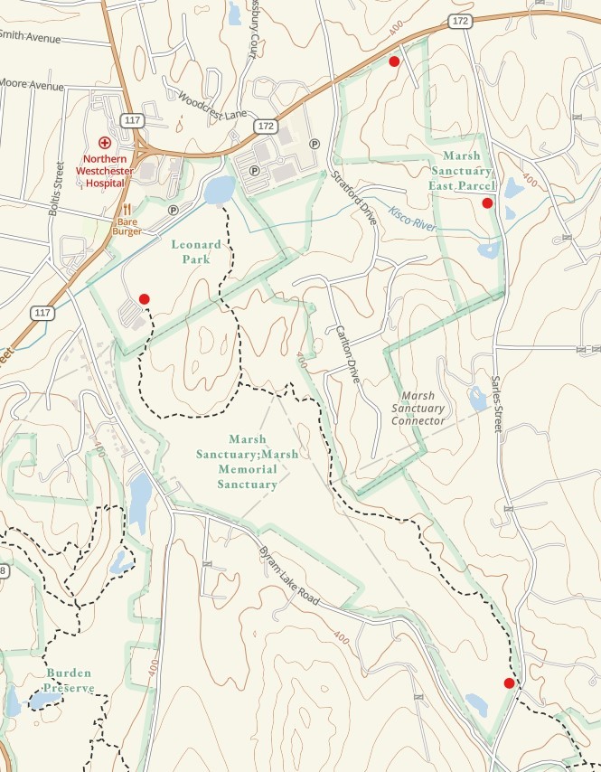
Parking areas are indicated by red dots.
|
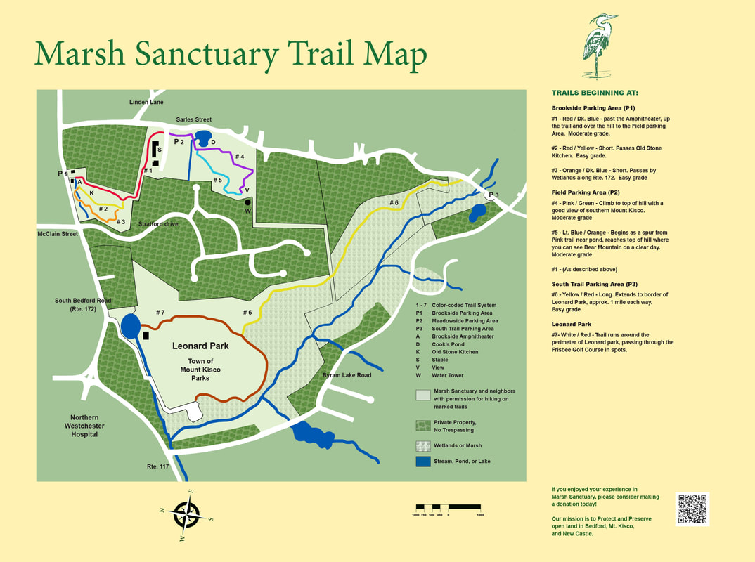
Click on the Marsh Sanctuary map below to download the PDF version.


